Day 2: Carousing in the Crescent City
Main Page >
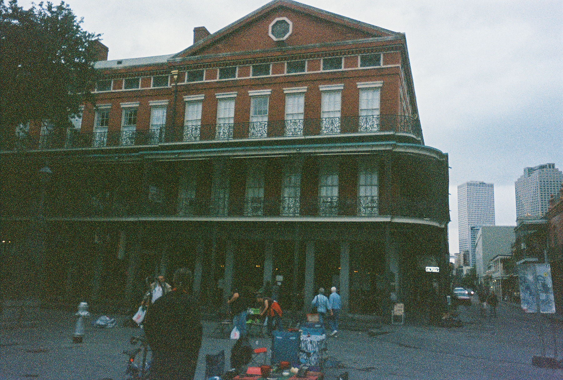
Bone Alone
Tours >
2008 Lagniappe Thanksgiving Tour
>
Thanksgiving started with Bone giving thanks that his head was
still attached after waay to many Hurricanes. But with a National Park Tour of
the Big Easy scheduled for 9:00 AM Bone was able to walk down to the French
Market in time for a quick fast to break !
A Blurry Bone, Beignets, and Chickory Coffee at Cafe du Monde
!!

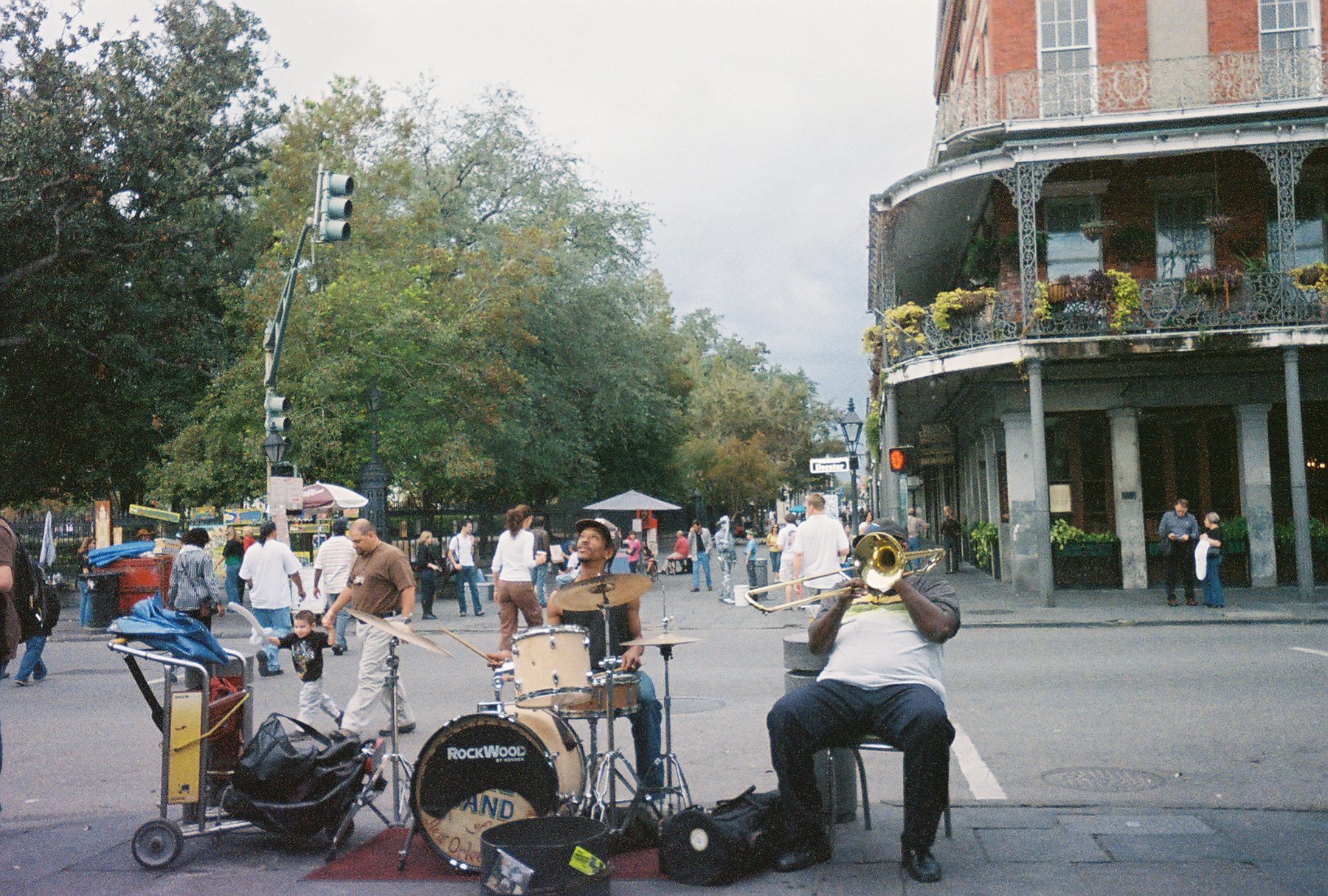
Nothing clears the head like fried dough, powered sugar, and
chickory coffee, especially if you are a Diabetic! Grabbing an extra coffee to
go, Bone walked out into the Grey, drizzle to the National Park office in the
French Market to gather with the other tourist.
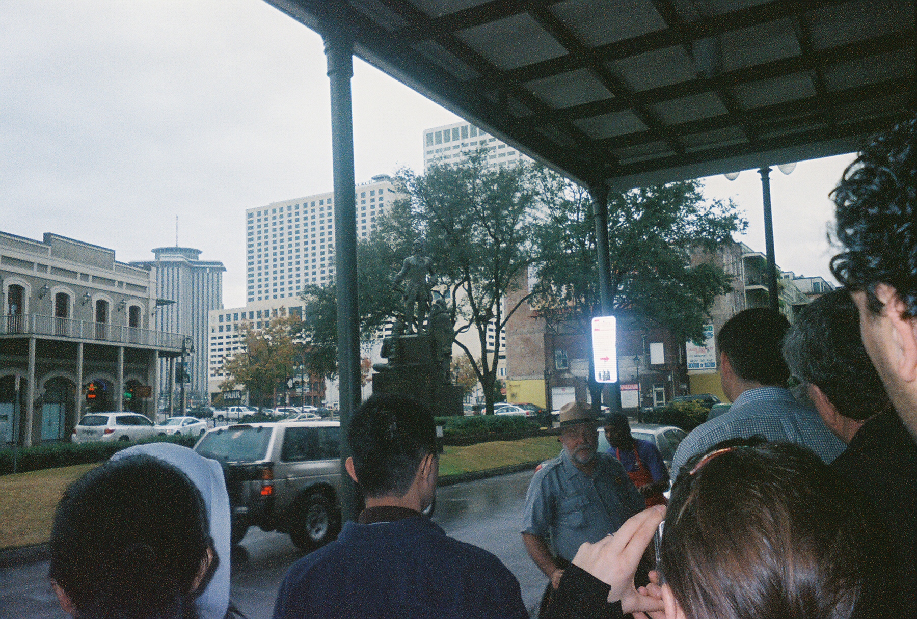
Learning the History of the Big Easy, on the Crescent of the
Mississippi River in the Crescent City !
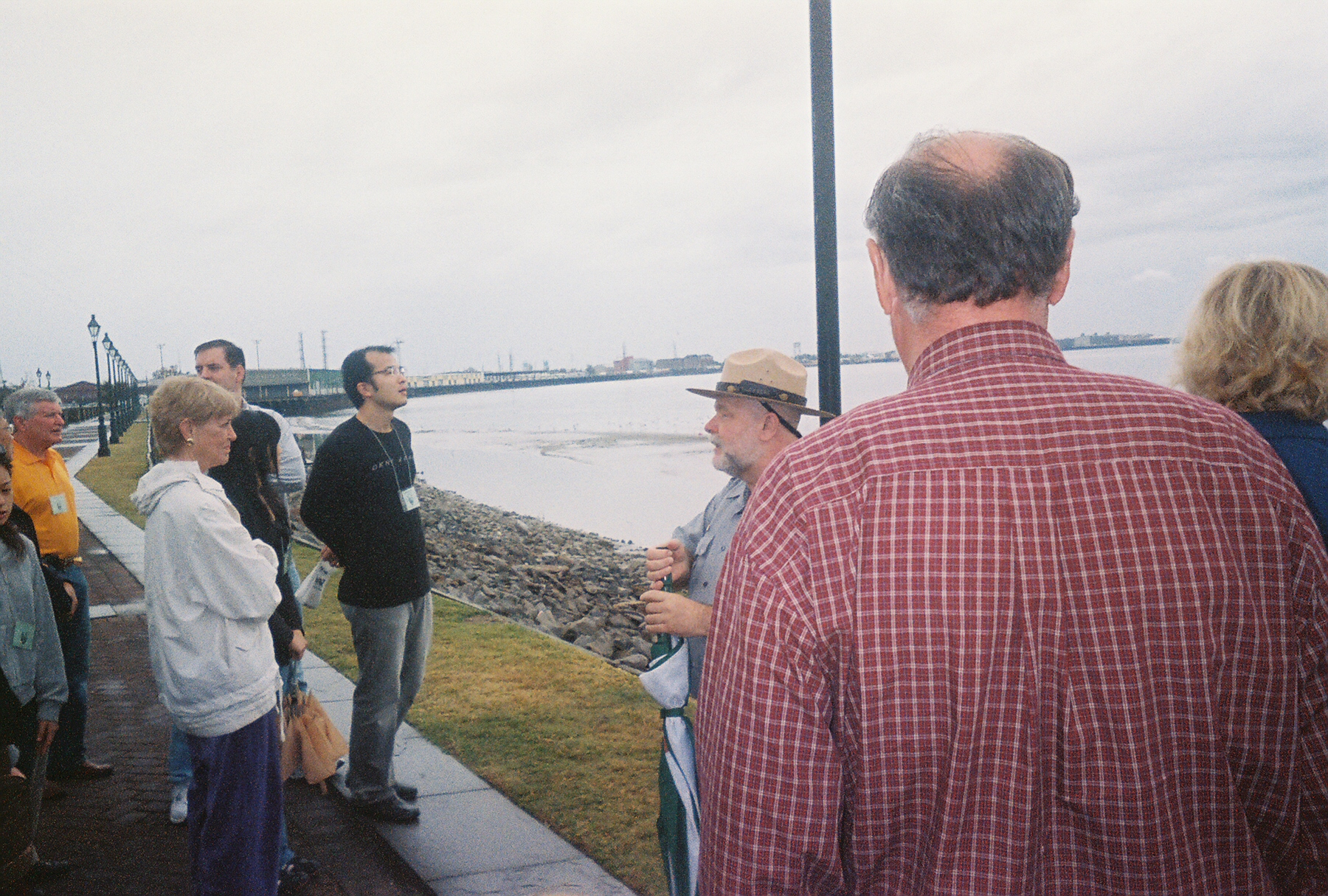
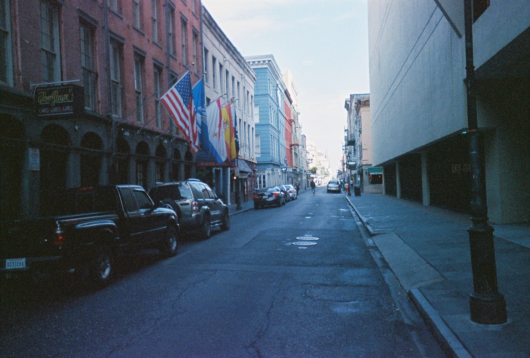
The weather turned ugly as Bone walked the "Moon Walk" along
the Mississippi where the animated National Park Ranger went into the rich,
complex history of the Big Easy.
Why Here
All cities' destinies are largely determined by geography and
geology, but New Orleans' more so
than most. It would, in fact, be impossible to understand the history and
economic development of New Orleans
without some knowledge of its unique situation and site. For,
New Orleans' economic fate--indeed, its raison d'etre--as
well as the pattern of its internal physical growth have been shaped by the
Mississippi River. From its beginnings, New
Orleans
has been a city wed to river and ocean; an almost natural dock for the
transshipment of goods.
The problem of finding a site for the "inevitable city" has
to do with the nature of the lower Mississippi
itself. The Mississippi is unusual for North American rivers in that it has a
large delta and is not embayed, i.e., the sea does not enter and flood the
river's mouth. Rivers that are embayed provide natural sites for cities. London,
New York, Hamburg, Quebec City are all located at a narrow inland neck of an
estuary, the first site where ships could go no further and where land traffic
could cross the river.
The Mississippi,
however, lacks any such well defined head of navigation before
Minneapolis; and south of Cairo,
Illinois, the Mississippi
is almost uniformly wide, with no one spot easier to cross than any other.
Moreover, the river is most shallow and treacherous at the sandbars crossing its
mouth in the
Gulf of Mexico. Where the river meets the gulf is nothing
but marsh and watery muck, a desolate scene that extends so far out into the
gulf, it created more difficulties for both seagoing and coastal vessels. With
no distinguishing features except mud banks and salt marsh tufts, the river's
several mouths and labyrinth of bayous made the three true entrances difficult
to find. Moreover, with no way to enter, save through one of the mouths, an with
no way to cross the river upstream, coastal ships had to leave the sheltered
coastal waterways and enter the Gulf to round the delta.
Early mariners were forced, then, to ask three basic
questions as to where their vessels could go and where a city could be located.
The basic questions were: Was there a way for deep-water vessels to reach the
river other than by entering its mouth far out in the Gulf? Was there a
sheltered way through the delta for coastal vessels to avoid the open waters of
the Gulf? Was there a place in the delta's featureless slimy muck where goods
could be unloaded and stored without risk of frequent flooding?
The answer to each question, the French found, was "yes," but
a tentative yes. There was a site for a city, but there were numerous problems
associated with it. The site where New Orleans
would be founded and eventually flourish can best be described as "wretched."
The delta environment has shoe-horned New Orleans
into a constricted site and forced the city into strange shapes and curious,
even eccentric internal patterns of growth. The environment, like the city's
personality, is an off-spring of the Mississippi River
and a direct result of its behavior in its lower course over the last several
thousand years. Like the city it spawned and nourishes, the
Mississippi
is unusual, not just for its size and delta, but for other eccentricities.
The problem of silting was largely resolved by Col. James
Eads, now a New Orleans folk hero,
who designed and built the Eads Jetties at Southwest
Pass in the late 1870's to force the
river to scour a reliable, deep-water channel for ocean vessels. Today, the Army
Corps of Engineers has the responsibility for maintaining the clear channel of
forty feet.
In its past, the Mississippi
built and abandoned several distributaries. Two abandoned distributaries that
meander through the New Orleans
area have left important marks on the city. One was the Bayou Metairie Gentilly,
which left the Mississippi
about twenty miles above the French Quarter at Kenner Ridge, and wandered
eastward towards the Gulf, parallel and north of the river. Never an important
water route, the bayou was paralleled by a ridge of well-drained land that
offered a dry land route into New Orleans,
from the west via Metairie Road
(Metairie Ridge) and from the east via Gentilly Road and the
Chef Menteur Highway (Gentilly Ridge).
Metairie Road was always, until recently, a bucolic
path, since it ran parallel to River Road,
the only road to Baton Rouge. But
Gentilly Ridge was always the mainland route into New
Orleans from the east, carrying first the
Louisville
and Nashville Railroad, and later U.S. Highway 90. The other abandoned
distributary, Bayou Barataria, has always been less important, since it led
south into the swamps where no one but Cajuns and pirates (Jean Lafitte) wanted
to live until recently, when suburban developments began to appear.
The river's other method of creating land is more spectacular
and usually wreaks radical geographical changes in its delta. Periodically, the
Mississippi
overflows its bank, dropping its coarsest sediment (silt) in a belt along the
riverbank. Further away from the banks, as the overflow slows, very fine, almost
microscopic particles are deposited, taking days to settle, in areas one or two
or more miles from the river that until recently were perennially flooded, low
swamps. Here, in these forlorn and pestilential areas, called "backswamps," the
sub-microscopic material, or ooze, mingled with rotting vegetation to produce
peat, and eventually soil, but soil of a peculiar nature -- a black, slimy
material the consistency of which varies between thick glue and thin soup.
The backswamp in "Uptown" New Orleans
(upriver) was an especially odious place, rounded on three sides by the great
semicircular "Crescent Curve" of the Mississippi.
The three banks, or natural levees, of the Mississippi together with the lower
natural levees of the abandoned Bayou Metairie (Metairie Ridge) created an area
like a shallow "bowl," with the center below sea level and prone to filling up
with water after heavy rains or flooding. Until ways were found in the twentieth
century to pump water out, the center of much of modern Uptown and Mid-City was
always wet. In pre-historic times, when water rose too high in the "bowl," it
would spill over the lowest spot in the Metairie Ridge, eventually forming a
slow sluggish stream, Bayou St. John.
With each flood, the Mississippi
has also raised its banks or natural levees higher. At New
Orleans, the natural levees average ten to fifteen feet
above sea level and one to two miles in width, sloping gently and almost
imperceptibly into the backswamp. So uninviting was the backswamp as a place to
build, that for some 200 years New Orleans
was confined to its natural levees of the Mississippi
and the Metairie and Gentilly ridges. In southeast
Louisiana, since only the natural levees are well-drained, relatively safe from
flooding and allow the building of roads and structures, nearly all settlements,
urban and rural, are located on the natural levees of the Mississippi and its
distributaries.
While building its levees higher, the
Mississippi
extends then further into the Gulf. As it does so, the river also raises its
riverbed higher. To maintain its current, the river requires a gradient.
Whenever the current slackens, material is deposited in the riverbed. So, as the
river extends itself into the gulf, its upstream stretches rise higher and
higher with each new flood and each addition to the natural levees.
Consequently, in many of its stretches in south Louisiana,
the Mississippi stands higher than
its adjacent flood plain. For this reason, all small streams in south Louisiana
flow away from or parallel to the Mississippi's natural levees. Since none of
the small streams can cross the Mississippi,
intra-coastal shipping was impossible in the Mississippi's
delta until a canal with locks was built in 1909. In the
New Orleans area, the Mississippi
stands ten to fifteen feet above sea level, perched on a ridge above much of the
modern city.
Throughout its geologic history, the
Mississippi
has changed its course numerous times. The river's former main courses largely
determined the pattern of modern settlement and transportation routes in
southeast Louisiana. One, the
Bayou Teche, is the main artery of Cajun Louisiana; its natural levees
supporting such Cajun centers as St. Martinville,
Breaux
Bridge, New
Iberia and Lafayette.
Halfway between the Teche and New Orleans,
Bayou Lafourche is a more recent ancestor of the
Mississippi. The St. Bernard Delta, east of
New Orleans, is another former course of the
Mississippi. These former courses all run parallel to
one another, but they are separated by swampy troughs. Until recently, all roads
in southeast Louisiana were limited to natural levees and ran parallel to one
another, which made travel in and through Cajun country difficult and left New
Orleans poorly connected with its immediate hinterland.
The Founding
The first Frenchman to explore the lower Mississippi was Rene
Robert Cavalier, Sieur de La Salle, who passed by New Orleans' site in April
1682 on a float down the Mississippi from Canada. De La Salle claimed the entire
river basin from the Appalachians to the
Rockies
for France,
naming the area Louisiana in honor
of Louis XIV and his Austrian bride Queen Anne. The French explorers who
followed La Salle into the region kept looking for high
ground, but at first found none satisfactory enough for a settlement south of
Baton Rouge. So, the French at first tried to get around
the geological and environmental problems posed by the
Mississippi's delta by founding
Baton Rouge and by building a string of forts along the
Gulf
of Biloxi,
Dauphin
Island and
Mobile. However, Baton Rouge
soon proved unsatisfactory as a portage point between the
Mississippi
and the Gulf of Mexico, and the coastal forts made for a
too insecure hold on the Mississippi.
The route from Baton Rouge to the Gulf -- through the Mississippi Sound to Lake
Borgne, then via Pass Manchac into Lake Maurepas and finally up the Amite River
to the back side of Baton Rouge -- proved to be too long and out-of-the-way.
An easier, shorter route between river and gulf was found as
early as 1699 by the brothers Bienville and Iberville, with the aid of the
Choctaws, who had used it for centuries. From the Gulf, sailing vessels at first
followed the same route as that to Baton Rouge
-- through the Mississippi Sound into
Lake
Borgne, then through the Rigolets
into Lake Pontchartrain. However, once in Lake
Pontchartrain, the route turned south into the Bayou St. John, a
four-mile long stream which flowed off the backslope of Metairie Ridge into the
lake. From the headwaters of Bayou St. John to the
Mississippi
was only a two mile portage across the relatively well-drained land of the
natural levee created by the river's great crescent curve. Besides being the
shortest route to the Gulf, the site had obvious geographical, military and
commercial advantages. The French had soon realized that their forts along the
Gulf
Coast were unable to assure control
of the Mississippi. A garrison
town near the mouth of the river with a shorter backdoor route to the Gulf that
could be protected by forts would assure control of the river and the lower
Mississippi
Valley. In 1718 Jean Baptiste La
Moyne, Sieur de Bienville, established New Orleans
as the capital of Louisiana and a
fortress to control the wealth of the North American interior.
At first, however, New Orleans
was more important as an image than it was in reality. Surrounded by the waters
of river, lake and swamps, the French referred to New
Orleans as the "Isle d'Orleans." And, indeed,
New Orleans was an island, not just in the physical sense
which was true after slight improvements were made at the site, namely a
three-foot artificial levee which kept out all but the worst floods -- but a
cultural island, too. New Orleans
was far better than the surrounding swamps, and quickly became a haven for
travelers on the Mississippi. The
city became an island of civilization in an ocean of wilderness: a particularly
brilliant beacon in the surrounding darkness, and a prize eagerly sought. Once
New Orleans had that image, no other city could hope to
compete for command of the Mississippi
Valley. New
Orleans, then, began as a cultural as well as a physical
island, an island poorly connected with the immediate hinterland, but with
superb connections with the larger world. As an oasis of civilization in a
hostile swamp, New Orleans came to
feel itself a very special place. Having conquered the dismal swamp,
New Orleans was confident of a brilliant future.
From 1718 until 1810, New Orleans
was essentially European in its physical shape and design and in human
orientation. Decreed a city at its founding by Bienville in 1718,
New Orleans was laid out by the French engineer, Adrien
de Pauger, in a classic eighteenth-century symmetrical gridiron pattern. The
plan with its central square, church, walls and towers embodied the
eighteenth-century Enlightenment ideal of the perfect city implanted in the
New World; but the reality was otherwise. For many years, the walls
were only straggling wooden palisades, the square was choked with weeds, most
buildings -- including the church -- were simple, wooden structures, and the
streets were little more than muddy ruts. Yet none of this mattered, nor did the
fact that there were not enough people to fill the grid until 1800. What
mattered was that from the beginning, New Orleans
had a reputation as a very important place; and for most of the eighteenth
century, image was more important that reality.
During the eighteenth century, New
Orleans' growth was slow and difficult. Although its
geographical situation, strategically important site, and master plan for
development guaranteed New Orleans a bright future, the realization of that
promise was dependent upon the ambitions of the dominant political powers of the
day, the limitations of the physical environment, the technology, the social
institutions and the political, philosophical, and psychological habits that
determine what we think we can do, or cannot do. In particular, for early
New Orleans, the promise of its strategic situation
depended upon which political power controlled the interior of North
America. In the eighteenth century, three European powers,
France,
Spain, and
Britain
were rivals for dominance. However, all three would give way before the first
independent North American power -- the emergent
United States.
The French
The forty-five years of French rule were the slowest and most
painful for New Orleans. The reason
for this had to do as much with the French attitude towards emigration as it did
with the economic policies of the French Crown. In
Louisiana, as in Canada,
the French failed to populate their territories adequately. The Bourbon
government feared heretics and Englishmen (the two, often synonymous in French
minds), and preferred conservative, Catholic Frenchmen as settlers. All settlers
were screened carefully, but most conservative Catholic Frenchmen much preferred
France
to the Mississippi Delta. The French who did emigrate were suspicious of
outsiders; and, the rural Acadians ("Cajuns") who settled the countryside around
New Orleans in the 1760's, after being hounded out of
Canada, especially disliked Protestants and
Englishmen.
France's
economic policy -- mercantilism -- also worked against rapid growth.
Mercantilism essentially held that all economic activity should be regulated by
the state for the benefit of the state. Thus, colonies existed solely for the
benefit of the state, providing the mother country with raw materials and
markets for finished goods -- i.e., a minimum investment in, but a maximum
return for the colonies. For most of her rule,
France
saw little indication of large financial returns from her
Louisiana
colony. The French thought of Louisiana
and the Mississippi
Valley
as a buffer against British expansion westward from their seaboard colonies, and
as a challenge to Spanish predominance in the west and southwest of
North America. France,
then, saw no point in investing large sums in Louisiana,
except for the brief period from 1716-1722, that saw the founding of
New Orleans.
The reason French opinion changed in these years was a
brilliant financial scheme hatched by John Law, a Scotsman, gambler, and
financial advisor to the Duc d'Orleans, who was regent for the young Louis XV.
Orleans, a rake and a gambler himself, as regent was
struggling to meet the huge debts that were the legacy of Louis XIV's numerous
wars and extravagant palaces. Orleans
eagerly agreed to Law's scheme that the Mississippi Company be formed to assume
the French Crown's debt in return for a charter to operate
Louisiana
as a colony. Law's ingenious proposal called for the proceeds from the sale of
shares in the Mississippi Company to the French public to be used to back the
Crown's debt and currency. Shareholders would receive dividends on the profits
the Mississippi Company would reap from the riches to be found in
Louisiana.
Law launched one of the first modern public relations
campaigns to convince thousands of Frenchmen of the fortunes to be made in a
Louisiana
rich in gold and fertile land. For two years, frenzied speculation shot the
value of Mississippi Company stock upwards as Frenchmen of all persuasions
rushed to invest their savings. But, by 1720, when no bonanza of dividends had
been forthcoming, the "Mississippi Bubble" burst. The company collapsed when
thousands of Frenchmen rushed to unload their shares, and Law fled
France
just ahead of an irate mob.
Law had few problems financing his company, but he had great
difficulty in developing Louisiana.
The colony had no gold, and although there was much fertile land, the people,
technology, and infrastructure to develop agriculture were lacking. Law tried
various schemes to attract settlers for Louisiana
and New Orleans, but his efforts
were undone by rumors of the excessive heat, mosquitoes, humidity, and disease,
and by the natural reluctance of Frenchmen to emigrate. Law did settle some
2,000 Germans from France's
eastern border on the Mississippi
just north of New Orleans, where
they began farming and also soon "gallicized" their names. But, his attempt to
import prisoners from French jails failed since, once loose in
Louisiana, they simply resumed their antisocial
behavior.
In the end, nothing could save Law's company. The collapse of
the Mississippi Company in 1720 ruined thousands of middle-upper class Frenchmen
and destabilized the French currency. Most importantly,
France, from the King's court to the King's
kitchen, was left traumatized by the very idea of stock companies and
Louisiana. The Crown resumed control of
Louisiana, but for the remaining years of its rule,
France
did little to develop the colony. New Orleans
grew slowly, starved of both necessary capital and labor. Slow immigration
created labor shortages which encouraged the importation of slaves, so that by
1800 more than 50% of the colony's population was African-American.
The Spanish
Defeated in the Seven Years War (1756-63),
France
was compelled by the Treaty of Paris to cede
Canada
and all the territory between the Appalachians and the
Mississippi, including West Florida
and Louisiana, north of
Lake Pontchartrain, to Britain.
The rest of Louisiana, including
New Orleans, was handed over to the Bourbons of Spain.
Spain's 41-year rule was ultimately beneficial
to New Orleans, but for reasons only
indirectly related to Spanish ownership and economic policies. Plagued with even
worse domestic problems than France
and with growing unrest throughout her extensive, but tottering, empire in
Central and South America,
Spain
was too preoccupied to see New Orleans
as anything more than a sideshow. Not until 1769 did the French population even
acknowledge Spanish rule, and then only when faced with a Spanish military
force.
New Orleans was never really
integrated into Spain's
Empire, although shippers and merchants were allowed to trade with
Spain
and France and
their colonies in the Caribbean.
New Orleans
did grow under Spanish rule, primarily because of English Colonial and then
American settlement of the Ohio
Valley.
Spain was as
nervous as the French had been about the English colonists and the British. It
was obvious after 1763 that New Orleans'
close geographical ties to the British colonies in North America
were pulling the city into what would later become the American orbit. Anglo
settlers in the Ohio
Valley
sought trade outlets through the city, an within New
Orleans itself, the direction of growth was upriver. The
Spanish at first allowed Colonial and British traders to undertake much of the
high risk commercial shipping on which New Orleans depended; but in the late
1770's, a worried Spain revoked Colonial and British trading privileges.
However, the Anglo-Saxons, established in West Florida
(north of Lake Pontchartrain) continued to ship goods
through Lakes Borgne, Pontchartrain and Maurepas, setting up a thriving entrepot
at Pass Manchac. The Spanish soon realized that this thriving, but illicit trade
between the Anglo and the Latin commercial interests in the city was absolutely
essential for moving goods in and out of New Orleans.
Spain
and her empire were unable to supply the necessary provisions to
New Orleans or sufficient markets for the products of the
Mississippi
Valley.
With the American Revolution and the establishment of the
United States, American involvement in trade
with and through New Orleans grew at
a rate that increasingly alarmed the Spanish.
Spain
worried that New Orleans' rapidly
growing economy was tied too directly to the new
United States, but her final efforts to stem
the American flood backfired. Measures such as offering enhanced trading
privileges to Americans who would accept Spanish citizenship in
New Orleans only increased the inevitable linkages
between
New Orleans and the American
economy.
The Americans
Both Spain
and France
proved unable to hold New Orleans
as part of an empire against the Americans flooding into the
Mississippi
Valley after 1800. As the nineteenth
century began, France
was completing her revolution and was periodically at war with half of
Europe; and Bourbon rule in Spain
and throughout Latin America was near collapse. Napoleon
tried to reestablish the French Empire in Louisiana,
taking control of New Orleans from
Spain
in 1802; but financial troubles and the difficulty of holding French conquests
in Europe and the Caribbean led
him to sell all of Louisiana,
including New Orleans, to the
United States. The restored French rule had
been brief; on December 1, 1803,
official word of French ownership reached New Orleans.
A scant three weeks later came news that Louisiana
and New Orleans were American.
Thomas Jefferson, who negotiated the "Louisiana Purchase,"
had pulled off one of the great real estate buys in history.
The addition of Louisiana
to the United States
was inevitable. The young republic was moving inexorably westward, and its major
transportation system for moving people and goods was the
Ohio-Missouri-Mississippi river system. New Orleans
was the natural outlet for the agricultural products and manufactured goods
produced by the Americans flooding west of the Appalachians.
Since there were too few Europeans to hold New Orleans
against the American tide, it was New Orleans'
destiny to become part of the United States.
In December 1803, New Orleans' legal
and political realities finally became aligned with its obvious geographic and
economic realities as a critical part of a rapidly growing
United States. New Orleans'
situation was too important, its reputation too flamboyant to be ignored by the
United States any longer. New Orleans'
fate was determined by its particular political and economic conditions that
dictated its founding as a city.
New Orleans
Culture
Perhaps the most important resources of any economy are
people and their skills. Few censuses were taken during New
Orleans' colonial period, but it is estimated that about
250 people lived in the town during the early 1700's. By 1760, the population
numbered about 4,000, and by 1803, it was upwards of 8,000. As a port city,
New Orleans had a varied ethnic composition. The few
thousand Choctaw Indians living in the area when the French arrived had, by
1803, either left or mingled their blood with other groups. The French --
soldiers, settlers, prisoners, and casket girls (girls of good reputation who
were given transportation and a casket, i.e., trunk of household items) -- made
up the bulk of the population for most of the eighteenth century. Africans were
first brought to New Orleans
in the 1720's and sold as slaves, mainly to planers. The labor shortage was so
acute in the countryside that few African-Americans lived in the city. Even by
1803, there were probably fewer than 5,000 African-Americans in
New Orleans with more free men of color than slaves.
Commercial families from many European countries established
branches in the city, and John Law's efforts accounted for 2,000 German
immigrants. Spain made serious attempts to encourage Spanish emigration,
settling several thousand Canary Islanders in the 1780's twenty miles south of
New Orleans and also to the west of New Iberia. Ironically, the biggest influx
under Spanish rule was that of French-speakers: the Acadians who, expelled by
the British from Canada,
settled from the late 1760's through the late 1700's on all sides of the city,
particularly to the west, near modern Lafayette.
In the last years of Spanish rule, growing numbers of Americans settled and
around New Orleans.
Under French rule, New Orleans'
trade was largely a one-way affair: flour and most other necessities imported
from France or her other colonies, and virtually nothing to fill ships for the
return trip. Bienville complained throughout the 1730's about the lack of
provisions, but given the many wars of the eighteenth century and the numerous
pirates and privateers, France
was able to provide only minimum aid. Although any goods delivered in New
Orleans commanded high prices, private traders were reluctant to risk shipment
to the city because of the dangers, the fact that New Orleans was not on the way
to any other port (it was less expensive to unload in Caribbean ports for
eventual transshipment to New Orleans), the low likelihood of payment in hard
cash, and the lack of valuable goods to fill the ships' holds for the return
trip.
During France's
rule, New Orleans and the area
upriver produced few goods that could be exported. A few lumber mills were
built, and lumber, pitch, and other such products were exported. But lumber,
while it might fill the ship's hold was usually much less valuable than the load
of incoming necessities it replaced. For a while, ships were required by law to
accept a certain amount of lumber products aboard before being permitted to
leave port. Some indigo was exported from the plantations near
New Orleans, and tobacco was grown on drier land upriver
of Baton Rouge. Furs from trappers
in the Midwest arrived in New
Orleans along with some flour from Indians or settlers in
Illinois. But flour was usually imported from
Europe. So, throughout the French Period, a serious imbalance of
trade existed between New Orleans
and the outside world. Such a negative balance is typical of developing areas
and is usually counter-weighted by an inflow of investment funds. The French,
however, stung by the "Mississippi Bubble," saw little chance of profit from any
investment in New Orleans.
Economic conditions improved under the Spanish, but not
because of their attitude toward investment. Spanish colonial policy followed
strict mercantilist lines. Spain
sought the maximum expropriation of wealth, with minimum time and effort.
Nevertheless, the years of Spanish rule, from 1762-1803, saw steady growth in
commerce, mainly stimulated by British and Latin American businesses willing to
speculate in bringing goods to New Orleans. After 1730, there was an increasing
flow of agricultural products and even some manufactured goods down the
Ohio
and Mississippi River to New Orleans,
both for export to Europe
and for shipment to the eastern seaboard of the new
United States. The technology of the day made
water transportation the most efficient means of moving goods.
The City
The physical character of New Orleans
had changed tremendously by 1803. In 1718, Bienville had only managed to
construct several huts, a wooden house for himself, and a storehouse; no brick
building was built until the late 1720's. The "Cathedral" on Place d'Armes
remained a simple wooden structure for years, while the square itself was
overgrown with weeds. On three sides, the walls were simple wooden palisades,
and a three-foot levee faced the river. Throughout the French Period,
hurricanes, floods, and fires plagued these vulnerable structures.
New Orleans was not really a "city" until well into the
Spanish period. Most of the French wooden buildings were destroyed by the
devastating fire of 1788, and the Spanish had hardly rebuilt the city, when a
series of three hurricanes and another fire, all in 1794, destroyed the few
buildings that had escaped the 1788 disaster, as well as most of the new ones.
As a result, the architecture of the Vieux Carre is Spanish, not French, and
most of the existing structures date from 1795 or after.
Canal Street
Once the Americans took over the City, the Creoles, French,
and Spanish stayed in the older part of the city which is now known as the
French Quarter. Canal Street was the “division”, between the two cultures. Canal
Street (where a canal was supposed to be built) has a boulevard which the locals
to this day call a “divide”.
After a fascinating hour, the rain turned into a deluge
and the tour ended abruptly
Touring the French Quarter, the Home of Confederate General
PGT Beauregard
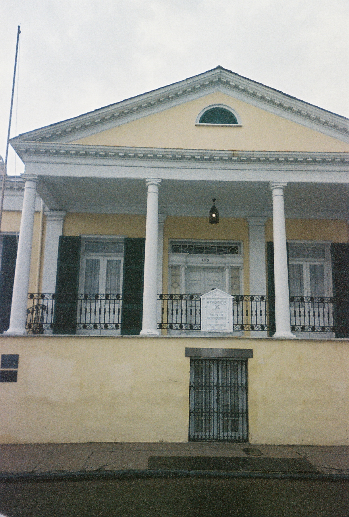
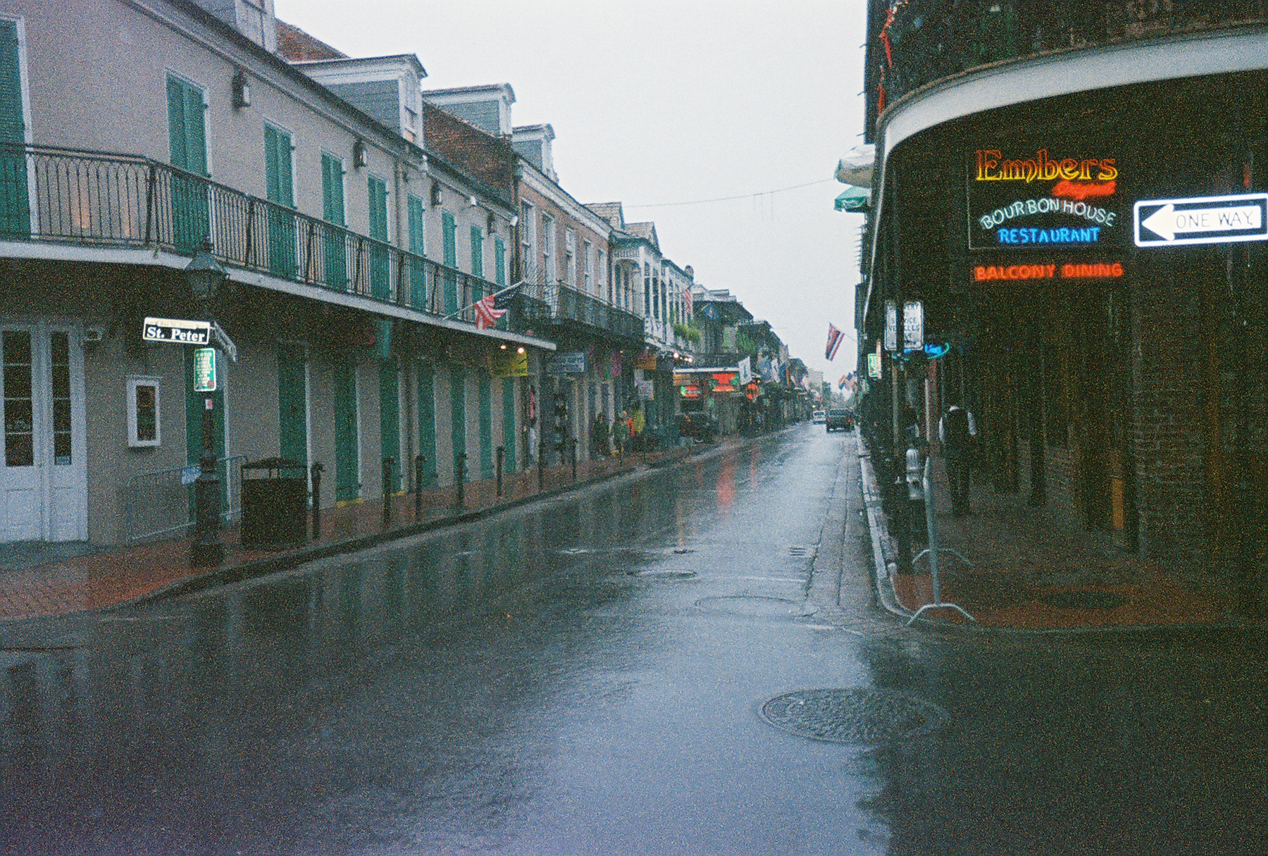
Bone found the Quarter fascinating, probably because there
was no one on the streets, it wasn't blazing hot, it was middle of the day, and
Bone was sober !!
Grabbing some Gumbo for Lunch
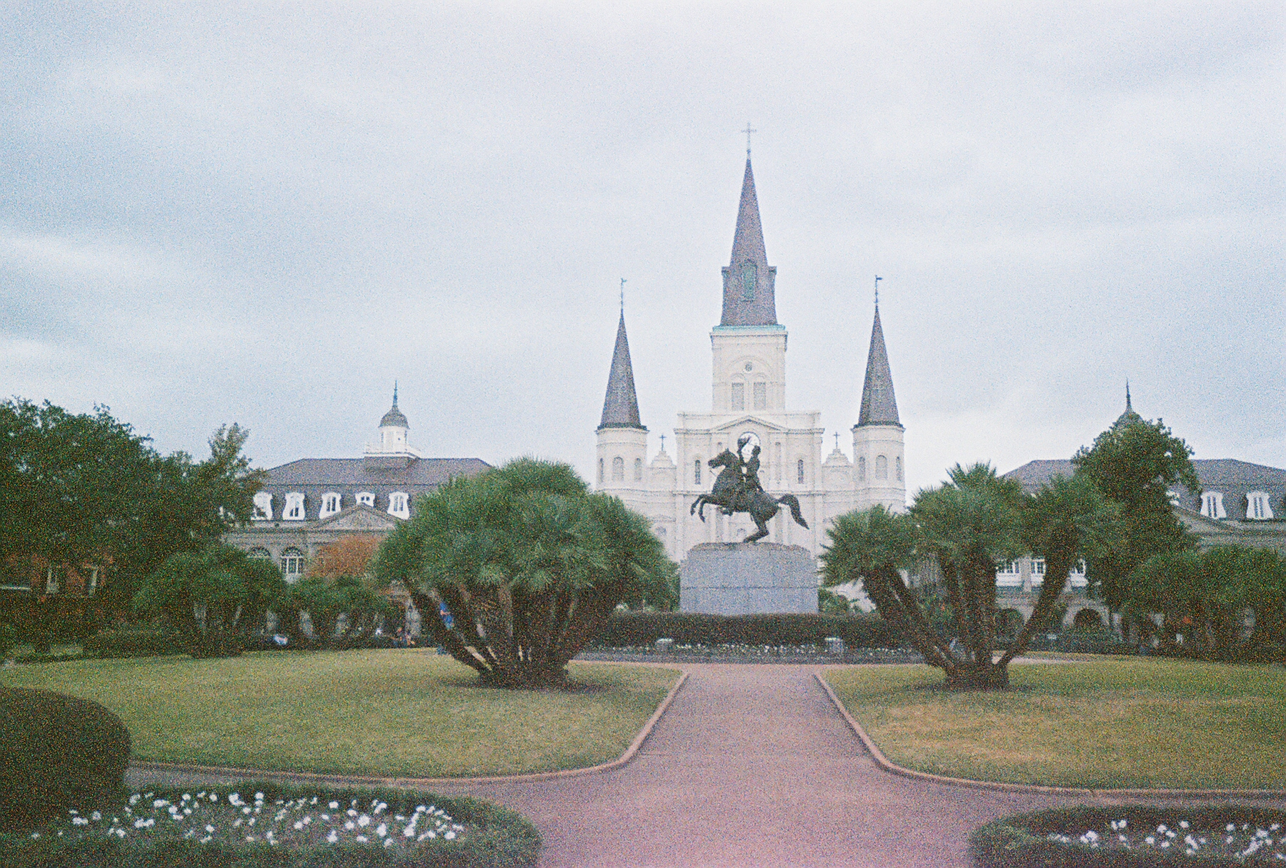
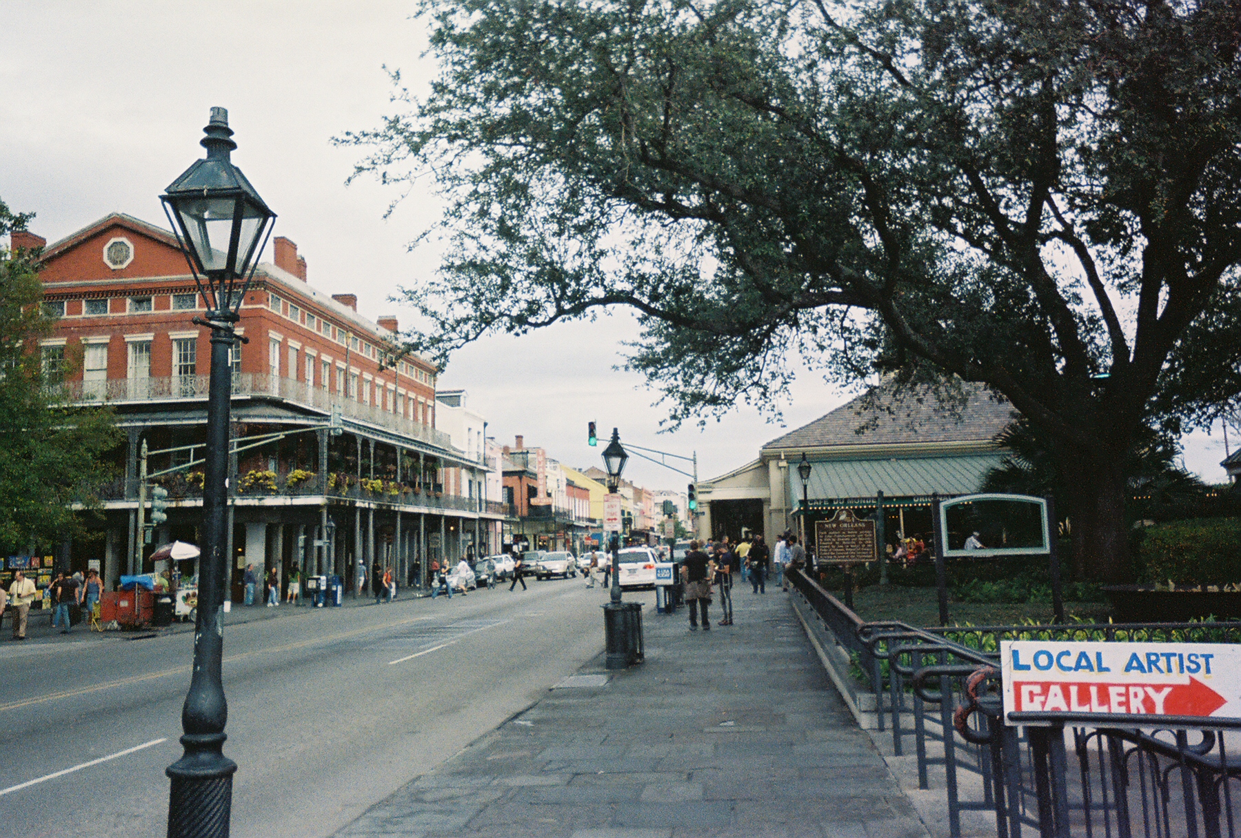
Finding a great little Creole restaurant in Jackson Square,
Bone had a quiet lunch of a seafood Po' Boy and an icey cold beer. After the
great lunch, the rain continued endlessly, so Bone headed back to his Hotel,
grabbed a few beers, and watched the "House" marathon on the USA Network till
Dinner time (nap included!)
A not so Traditional Thanksgiving Dinner
Now Bone has had Thanksgiving dinner in may strange places,
but the Big Easy was a first !. He headed to the famous Brennan's Restaurant in
the French Quarter, sat at the Bar and had Gumbo, Turkey, cranberries and Cajun
stuffing while watching a College Football game and drinking a fine pint of
Guinness !
After dinner Bone went into the Quarter for a few drinks, but
nothing as crazy as the night before and made it an early night.