Main Page > 2006 Getting our Kicks on Route 66 !!!
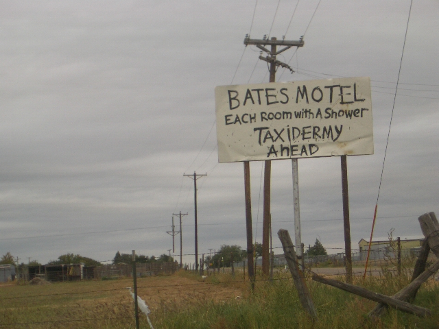
Rising early with a belch from the bad steaks or shiner bocks, the Boys broke their fast at the "Truck Stop Diner", where the server everything with a dollop of grease (even Bone's oatmeal !!) and second hand smoke. With their stomachs churning and coffees in hand the Boys headed out to check out Amarillo, which is the fourteenth-largest city in the U.S. and is the self-proclaimed "Helium Capital of the World" for having one of the country's most productive helium fields. The city is also known as "The Yellow Rose of Texas" is in reality a agricultural dump in the middle of the Pan Handle. Between the disgusting food at the Big Texan, the diner, and the faded, rusting town, the Boys jumped back on Route 66 westbound by leaving twin "anal breeze" salutes to demonstrate their contempt of Amarillo and the food it served !
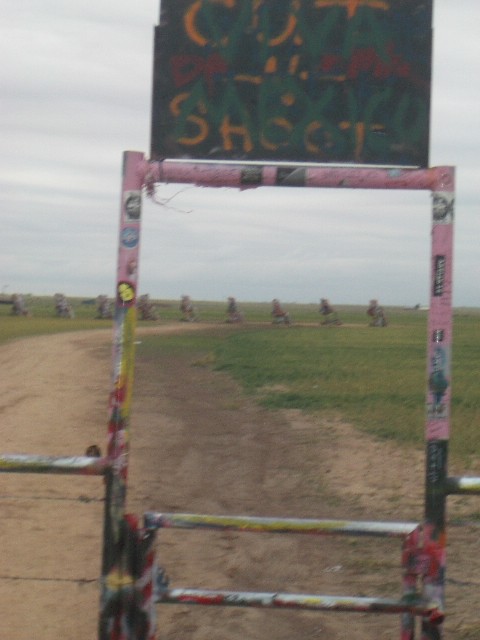
Cruisin' the Cadillac Ranch
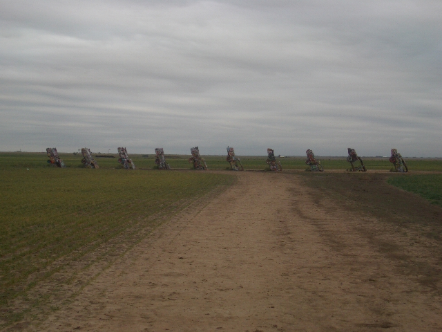
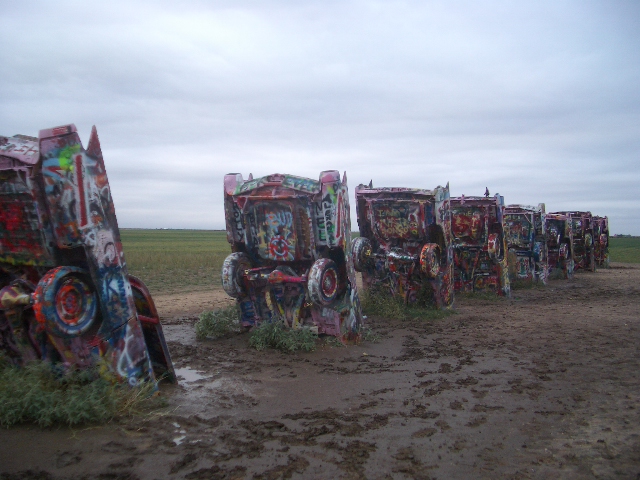
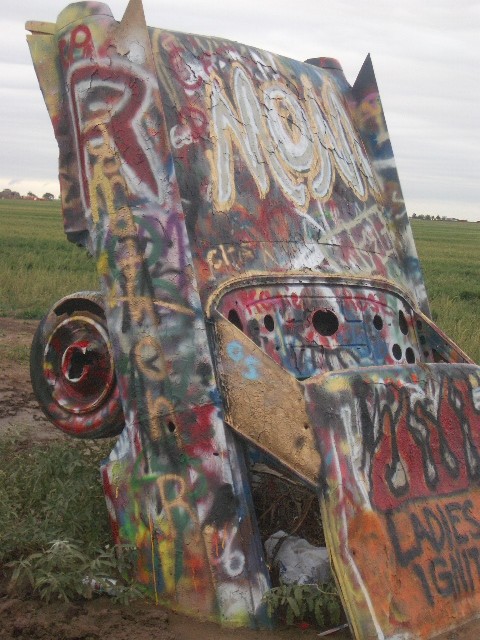
The Cadillac Ranch, located along the tatters of historic Route 66, was built in 1974, brainchild of Stanley Marsh 3 ("yep, that's his name !), the helium millionaire who owns the dusty wheat field where it stands. Marsh and The Ant Farm, a San Francisco art collective, assembled used Cadillac's representing the "Golden Age" of American Automobiles (1949 through 1963). The ten graffiti-covered cars are half-buried, nose-down, facing west "at the same angle as the Cheop's Pyramids."
It was an unusually cold, windy, and rainy morning, with the whole country experiencing a cold wave, so when the Boys pulled up to the Cadillac Ranch, Mike ran up snapped a few shots of the of monument to people having too many strange ideas and too much discretionary cash.
But is it better than a Holiday Inn Express ?
As Mike and Bone pulled back on to Route 66 they saw more of Stanley Marsh 3's handiwork with the pithy signs he has posted through-out the Amarillo area as evidenced from the one above.
"Boy, this is flat as a Panhandle, er ! Pancake !!!
Since this was the Boys third "Messing with Texas" attack in as many years they were able to contrast the differences in the terrain called the Llano Estacado in the Pan Handle, from the south-east and south-west parts of the state.
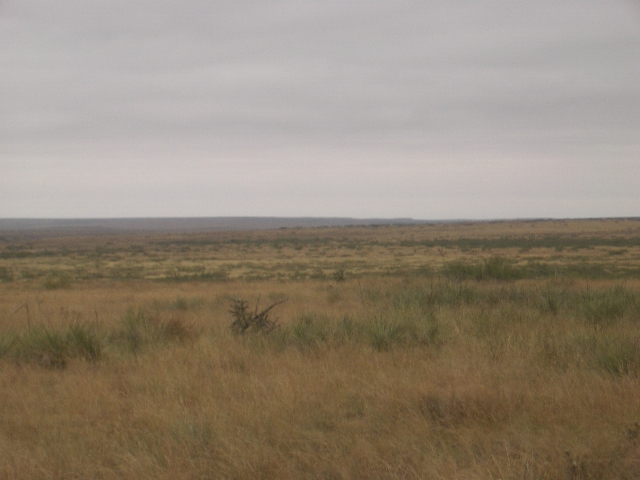
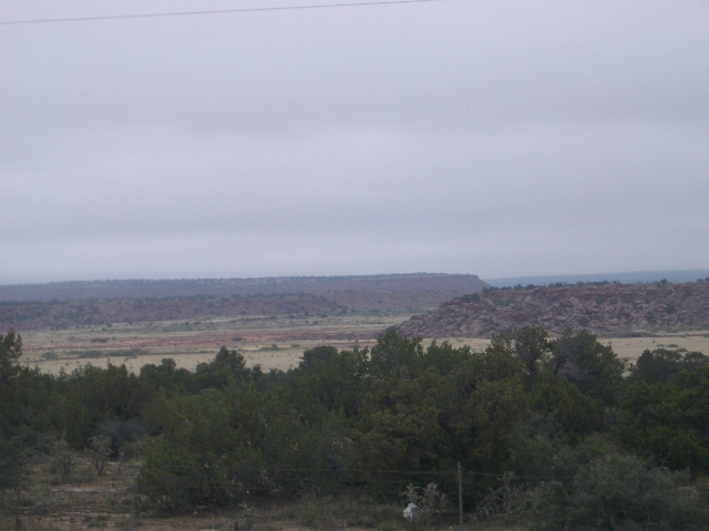
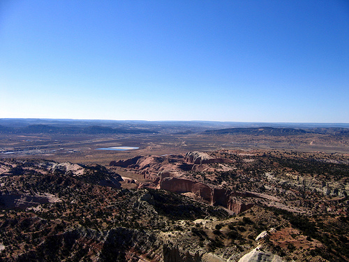
Llano what ?!? The Llano Estacado is part of the High Plains, straddling the Texas - New Mexico border between Interstate 40 on the north and Interstate 20 on the south, or, roughly, between Amarillo and Midland-Odessa, Texas. It is bounded on the west by the Pecos valley, and on the east by the red Permian plains of Texas. Its extent is, therefore, about 250 mi. north to south, and 150 mi. east to west, an area of 37,500 sq. mi. The Llano is a very flat, semiarid plateau, ranging in elevation from 5000' on the northwest to less than 3000' on the southeast, sloping more or less uniformly to the east-southeast at a rate of at least 10' per mile. The slope is imperceptible to an observer on the plateau. The Llano is dry and treeless, the prevailing wind is from the southwest, and mirages are a frequent occurrence under the hot sun.
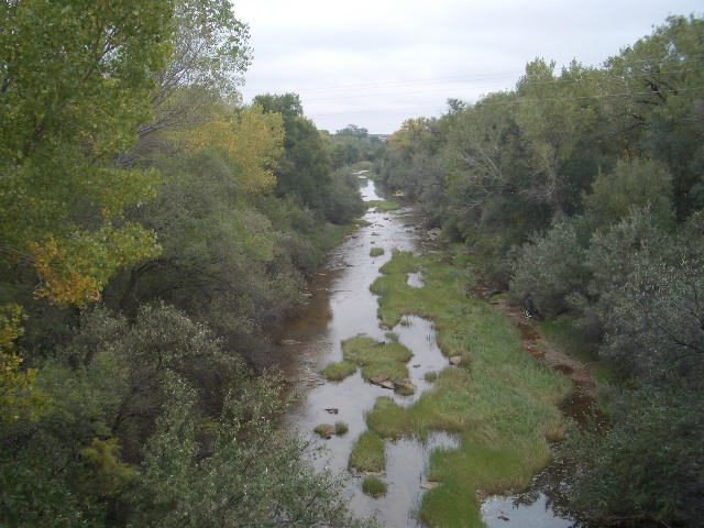
The distinguishing characteristic of the Llano is the Cap rock Escarpment, seen most prominently on the north and west sides, a precipitous cliff usually about 300' in height, seeming to be an almost impenetrable defense for the plain. The cliff on the north facing the Canadian river was seen by Francisco Vasquez de Coronado in 1541 on his way east from Cibola, leading him to name the plateau the Llano Estacado, or Palisaded Plain. The name is usually mistranslated Staked Plain, and fanciful stories have been created to explain this title. The cliffs are easily seen to the south from Interstate 40 just east of Tucumcari. This is probably the best place to view the feature that gave the region its name. The photograph below shows the escarpment from a point on the plateau south of San Jon, looking northeast. Fragments of the cap rock are seen in the foreground, and the escarpment on the other side of the Canadian River is seen in the distance. Further south, the Mescalero Ridge is a similar line of palisading cliffs, facing the Pecos valley.
There are several popular explanations of the name, all based on an incorrect translation of the word "estacado," which means "palisaded," not "staked." Some allude to yucca stems, others to actual stakes driven into the ground as landmarks, and still others to similar, even less plausible objects.
Mid-Point !!!
As the Boys passed through small, nondescript towns such as Bushland, where they were disappointed, expecting to see a them park based on our 43rd President, Tehas's own "W", and Wilderado, they drove into Vega Texas, which according to lore exactly 1,224 miles from Chicago, and 1,224 miles to Los Angeles. Vega was founded in 1900 as a railroad depot and is pretty much a depressed ghost town along with most of the towns in the Pan Handle.
Or was it ?!?
The next little town the Boys encountered was Adrian, which also boasts has the mid-point. The boys stopped in for a coffee in the Mid-Point Cafe where their slogan is "when you are here, you are half way there". Jumping back on the road they soon encountered the small little border town of Glen Rio, and drove into New Mexico.
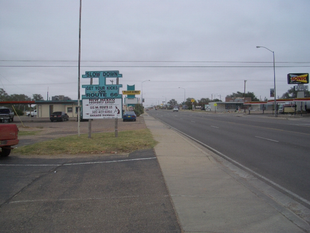
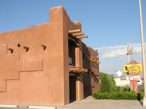
Route 66 in New Mexico
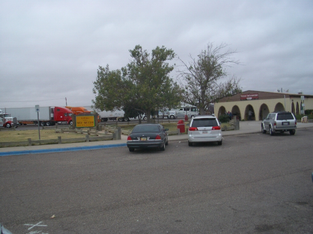
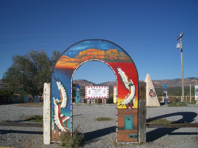
The New Mexico Border Visitor Center on Route 66
New Mexico - Land of Enchantment. The name is fitting in that the place, its Indian/Hispanic heritage, and traditions had been one of Mike and Bone's favourite Tour stops. The land is beautiful with its spreading plains, red rock mountains, and blue, blue skies, but beyond that there is a profound sense of respect one feels for the centuries of history and tradition that permeate the land. Perhaps nowhere is there a more successful co-mingling of disparate cultures to form a unique whole than there is here in New Mexico. Farmer, rancher, miner, Indian, Spaniard, Anglo, and again Mike and Bone, treaded on special ground.
One of the most important questions in New Mexico is "Red or Green?" "The choice of red or green chile sauce is a critical question in any New Mexican restaurants.
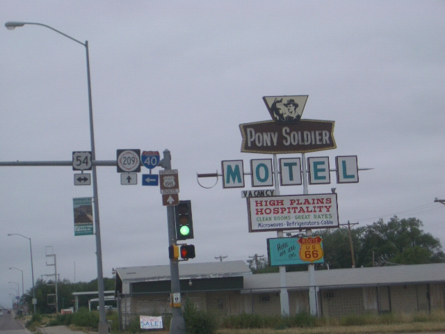
Truckin' through Tucumari
The first major stop for the boys was Tucumari (Pronounced two-come-carry.) There are two stories on the naming of the town, one romantic, one less so. The first is a legend that states that an Indian Maiden named Kari was so grieved over the death of her lover, Tocom, at the hand of a rival, that she took here own life. Her father, upon discovering the tragedy, exclaimed "Tocom ! Kari !! " A wonderful tale with shades of Romeo and Juliet, but the real name probably comes from the Comanche word for "tukamukaru", meaning "to lie in wait'" as in an ambush.
That's a hard story to Blue Swallow !!!
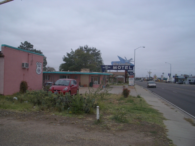
Oddly enough along with the name of the city, one of Route 66 well known landmarks is the Blue Swallow Motel, which also has a legend about it. The legend is that the Blue Swallow is named after the romance of a Michigan Football player and an Indian Princess with an oral fixation . . . . . . . . . . . . . . . . .
While the Route 66 book was impressed with Tucumari, Mike and Bone were not, it was a run down, tired-looking town without much activity nor seemingly people.
Good thing the car didn't have Injun Problems !!!
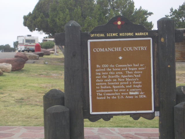
Part of the allure of New Mexico are all the Native America tribes. Route 66 goes right through several Native American Reservations, with the Comanche being the first reservation that the Boys cruised through during their trip.
Still cruising through the Escarpment
As the Boys continued west the morning continued to be cold, drizzly, and grey. They soon passed through the little town of Romeroville, which was not named after George A. Romero, the father of the Night of the Living Dead movies, but Don Trinidad Romero, a minor, local mucketedy-muck that once entertained President Rutherford B. Hayes ( another minor mucketedy-muck !!)
Poking around on the Pecos !!!
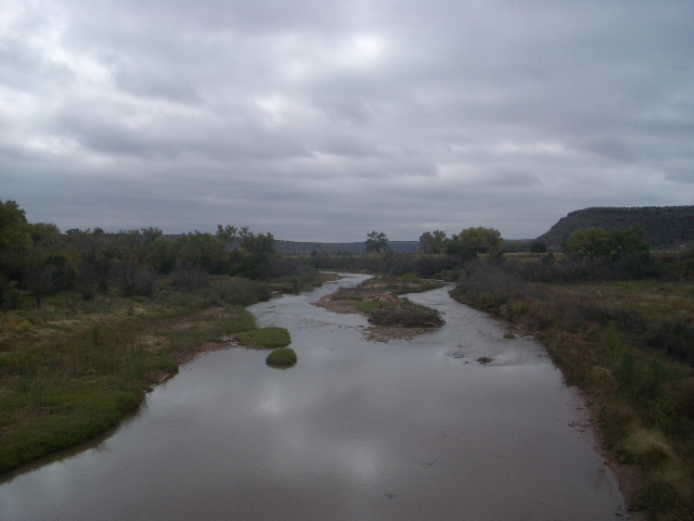
In Santa Rosa, the Boys pulled off Route 66 to check out the awesome desert mountain scenes and famous western river, the Pecos, where in the lore of the American West, Coronado made the crossing in 1541 looking for the City of Gold. In fact, in Santa Rosa Route 66 is renamed Coronado Avenue in honour of their local hero.
"..and I will have the GREEN Chile please !!!"
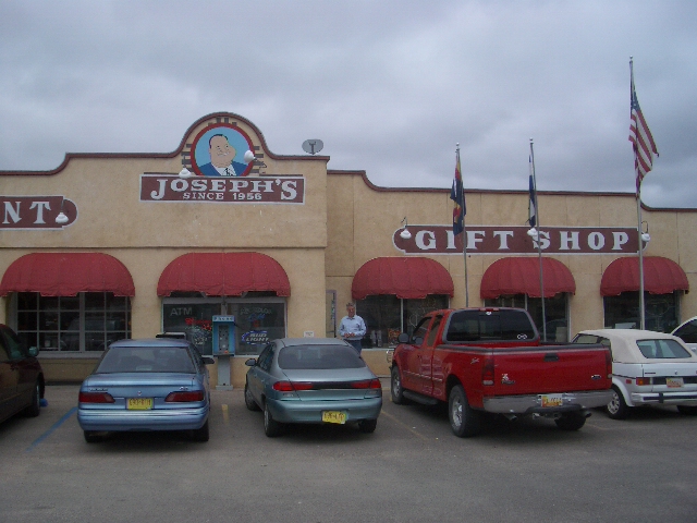
Just west of Santa Rosa, the Boys stopped for some darn fine green chile burritos and more java for lunch at Joseph's, a Route 66 favourite restaurant and Gift Shop.
"Ain't no mountain high enough !!"
a Motown hit
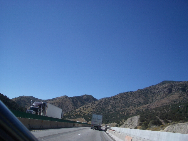
Heading out of Santa Rosa, the Route 66 starts climbing into a mountainous region on its way to the Continental Divide, where as the geography changed into the classic Southwest desert, where the skies magically cleared and it warmed up providing the Boys a lovely afternoon cruise.
Quirky Albuquerque
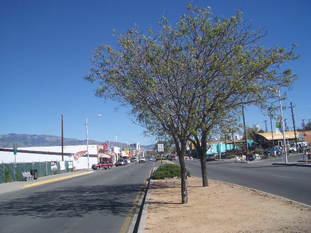
In the Boys prior trip to Albuquerque, they didn't really check out Old Town, where Albuquerque was first settled in 1705. Walking around in the wonderful, dry, early afternoon sun in Old Town, where they passed eclectic restaurants and B&B's, such as the 1912 Bottger Mansion which was played host to Machine gun Kelly and his Gang. After an hour of wandering around and enjoying southwestern/hip-hop ambience the Boys continued westward and upward Route 66 !!
A Eastbound Route 66 Monument in Albuquerque
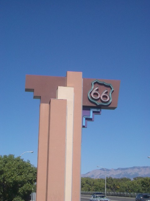
The city limits for Albuquerque City ends at the Rio Grande River. For eastbound traffic, there is this very cool neon sign on '66 right before the Rio Grande Bridge
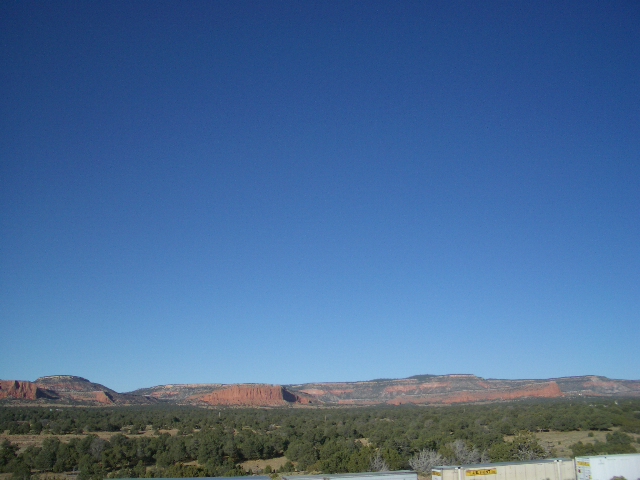
Lookin' down into the Rio Grande Valley into Albuquerque
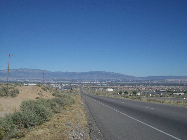
Leaving Albuquerque the boys were climbing at a pretty good clip up into the mountains, providing the Boys a unique vantage point overlooking the City and the Rio Grande Valley.
Stopping to "rest" in a Navajo Nation Rest Area
The constant flow of coffee caused the Boys to have to stop for a caffeine "drip," at a closed Navajo Gift Shop, the Boys drained and marvelled at the awesome red rock scenery in the high desert. As the day began to wane around 5:00 PM the Boys quickly shot thru quaint little western New Mexican towns such as Los Lunas, Puerco Rio (Pig River ?!?), Laguna, and Thoreau, that displayed that traditional dusty, big sky, western charm.
Going down hill to the Pacific: the Continental Divide
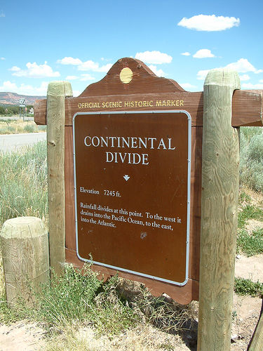
5 miles west of Thoreau in a community named after the Backbone of the North American Continent. There was a sign that Mike and Bone stopped to check out that explains that rainwater which falls west of this dividing line, flows westward to the Pacific, while that which flows to the east flows towards the Atlantic via the Gulf of Mexico. Unfortunately due to time constraints the boys did not have time to check out the Continental Divide National Scenic Trail, which starts from the Mexican Border and winds its way all the way up to Canada.
About 15 miles west of the Continental Divide is the turnoff for Fort Wingate, as was a base of operations for Colonel Kit Carson's campaigns against the Navajo, where he rounded up thousands and marched them 300 miles to Fort Sumner, or what has become known as the "Long Walk"..
Galloping into Gallup
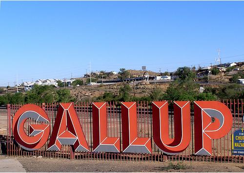
Around 6:30 the boys where running low on coffee and petrol, needing to replenish and recycle, the boys stopped to check out picturesque town of Gallup.
Viewing the Valley from Gallup


A "Cowboy" Muffler Man !!

The "Jewel of Gallup

Driving through Gallup, Mike and Bone checked out the El Rancho Motel and Hotel., "Boasting the charm of Yesterday and convenience of Tomorrow ", where many Hollywood westerns were shot. Clark Gable John Wayne, Claudette Colbert, were some of the stars that stayed at the Hotel el Rancho. However sadly for the Hotel, never enshrined a Mike and Bone stay !!!
Driving through Downtown Gallup


The Boys didn't have a lot of time to stay and check things out it town, but Gallup definitely appeared to be a place that would merit a return Mike and Bone visit !!
Route 66 in Arizona


As New Mexico ends on the Mother Road along I-40 into Arizona, the land becomes harsher than anywhere along the journey for Mike and Bone. The red rock is everywhere and water is no where.
Hanging Out In Holbrook

As the sun began its eternal cycle of setting (then rising), the boys decided to hole up for the night in Holbrook, a touristy sort of town between Route 66 and I-40, it is the home of the Wigwam Motel, and way too many petrified wood tourist shops.
The Rainbow Rock Shop


A Red Sunset in the Red Rock town of Holbrook

The Booze Brothers watch the Blues Brothers
After a long day of driving the thought of going out for dinner wasn't so appealing, especially after the last two evening of excesses. As the Boys checked into a Motel next to the Wigwam Hotel, they noticed that the Blues Brothers were going to be on the tube. Having been taking about the Blues Brothers for the last two days since seeing Joliet Prison, seemed only fitting that they stay and watch the classic salute to Blues music, so they ordered Pizza and got a 12 back of micro-brews and enjoyed Joliet Jake and Elwood, Ray Charles, Aretha Franklin, James Brown, and a cast of thousands. The Boys chomped pizza and slammed beers until the movie was over and called it an early night.